SCEC UGMS Committee Meeting
Conveners: C.B. Crouse and Tom Jordan
Dates: November 30, 2015 (10:00 - 15:00)
Location: SCEC Boardroom, USC, Los Angeles
SUMMARY: The SCEC Committee for Utilization of Ground Motion Simulations (or "UGMS Committee") is tasked to develop long-period response spectral acceleration maps for Los Angeles region for inclusion in NEHRP and ASCE 7 Seismic Provisions and in Los Angeles City Building Code. The maps would be based on 3-D numerical ground-motion simulations, and ground motions computed using latest empirical ground-motion prediction equations from the PEER NGA project. This project is coordinated with (1) the SCEC Ground Motion Simulation Validation Technical Activity Group (GMSV-TAG), (2) other SCEC projects, such as CyberShake and UCERF, and (3) the USGS national seismic hazard mapping project.
Presentation slides may be downloaded by clicking the links following the title. PLEASE NOTE: Files are the author’s property. They may contain unpublished or preliminary information and should only be used while viewing the talk.
Monday, November 30, 2015
| 10:00 - 10:15 | Welcome, Attendee Introductions, and Agenda Review | |
| 10:15 - 10:45 | Meeting Agenda Overview and Review of Results from May 2015 Meeting (PDF, 3.1 MB) | C.B. Crouse |
| 10:45 - 11:15 | Update on SCEC CyberShake Progress - Hybrid Approach to Broadband Ground Motion Simulations (Graves and Pitarka, 2010, 2015) (PDF, 3.9MB) - Broadband CyberShake Calculations (PDF, 1.1MB) - Discussion |
Rob Graves / Scott Callaghan |
| 11:15 - 11:45 | Calculation of Risk-Targeted Maximum Considered Earthquake Response Spectra (MCER) - Weighted Average of CyberShake and NGA-based MCER - Discussion |
Kevin Milner |
| 11:45 - 12:00 | Proposed approach to validating 3-D simulations before using them in engineering applications (PDF, 2.7MB) |
Norm Abrahamson |
| 12:00 - 13:00 | Lunch | |
| 13:00 - 13:30 | Updated Site Response Analysis (PDF, 2.7MB) - Discussion |
Domniki Asimaki |
| 13:30 - 14:00 | Technical Items for Resolution Before Finalizing Approach for MCER Calculations - SCEC web MCER look-up tool for city of L.A. & other users (PDF, 227KB) - Discussion |
C.B. Crouse / Tom Jordan |
| 14:00 - 14:30 | Logistics and Schedule for Finalizing Long Period MCER Maps for L.A. Region in Short Term (e.g., Possible supplement to ASCE 7-16 for City of L.A.) and Long Term (2021 NEHRP & 2022 ASCE 7) | C.B. Crouse |
| 14:30 - 14:50 | Future Work for CyberShake | Tom Jordan |
| 14:50 - 15:00 | Results to be Presented and Tentative Dates for Next UGMS Meeting | |
| 15:00 | Adjourn |
PARTICIPANTS
*Remote Participants
MCER Maps
A zip file with MCER results is available here.
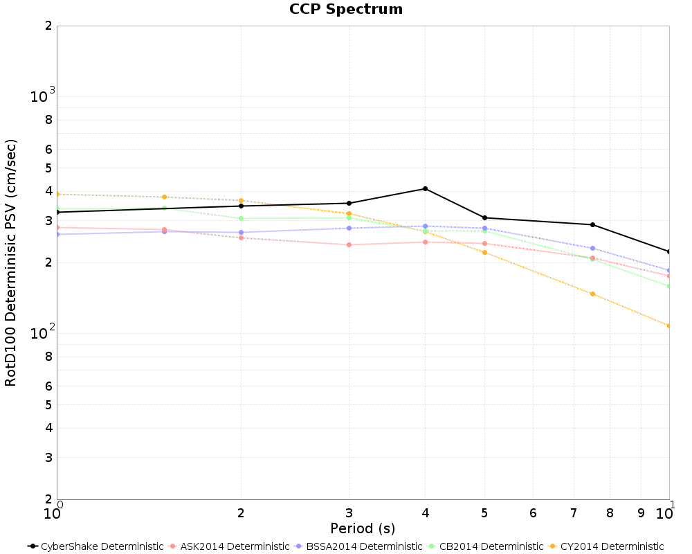
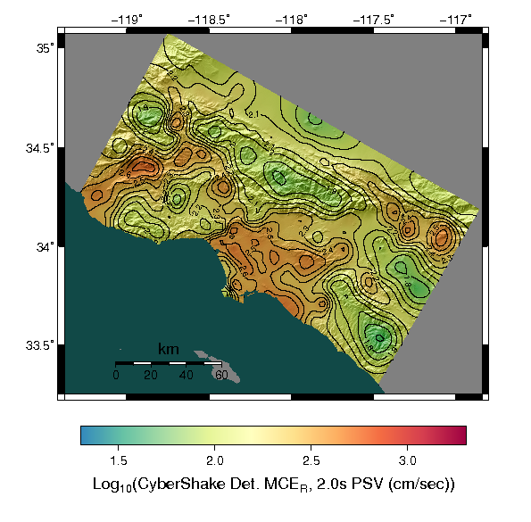
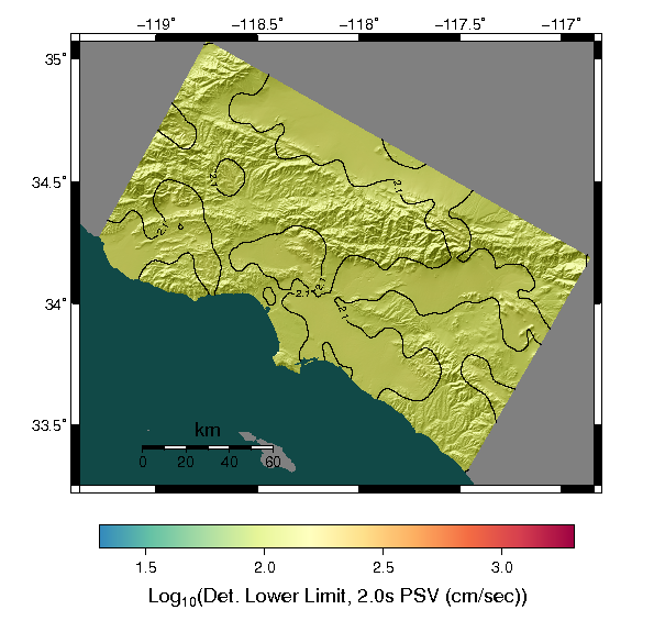
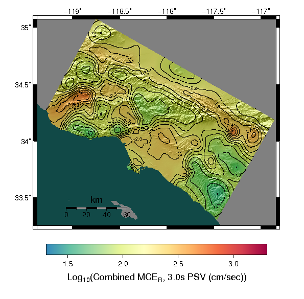
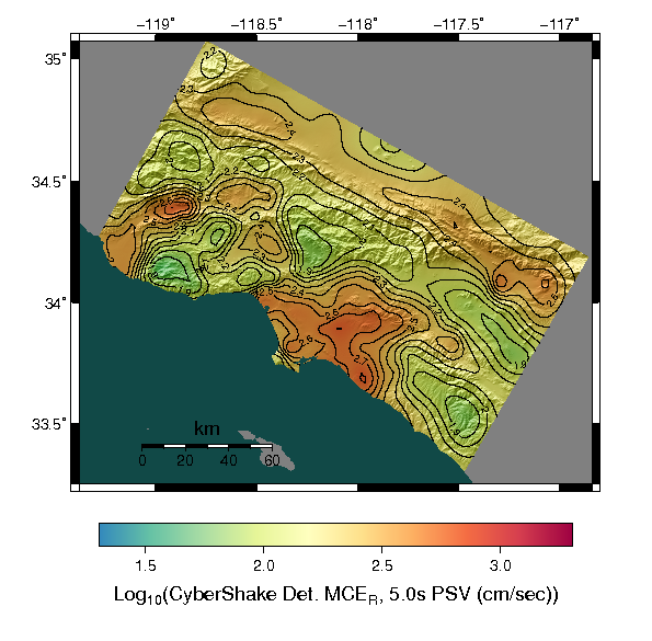
Maximum Considered Earthquake Response (MCEr) maps for the Utilization of Ground Motion Simulations Committee, interpolated between 336 Study 15.4 CyberShake sites.
| Period | Probabilistic MCER | Deterministic MCER | Deterministic Lower Limit | Combined MCER results |
| 2 Second, RotD100 |  |
 |
 |
 |
| 3 Second, RotD100 |  |
 |
 |
 |
| 5 Second, RotD100 |  |
 |
 |
 |
| 10 Second, RotD100 |  |
 |
 |
 |
| Period | CyberShake Combined MCER | GMPE Combined MCER |
Ratio (CyberShake/GMPE) | Weight Average |
| 2 Second, RotD100 |  |
 |
 |
 |
| 3 Second, RotD100 |  |
 |
 |
 |
| 5 Second, RotD100 |  |
 |
 |
 |
| 10 Second, RotD100 |  |
 |
 |
 |
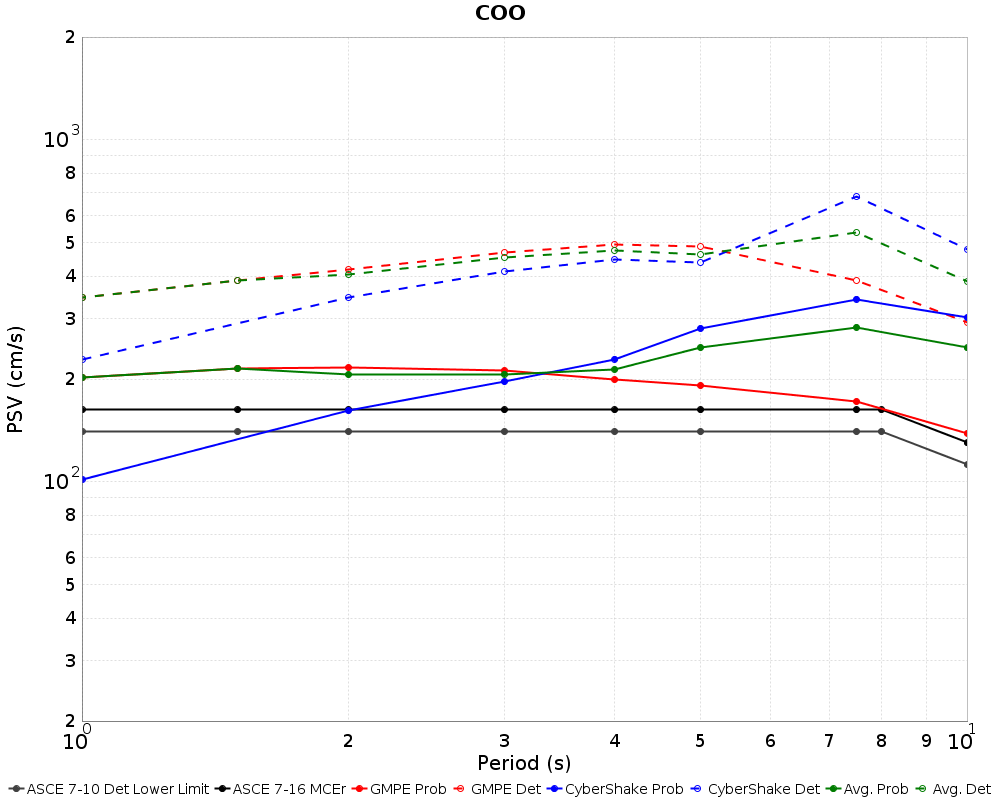
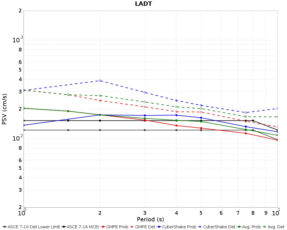
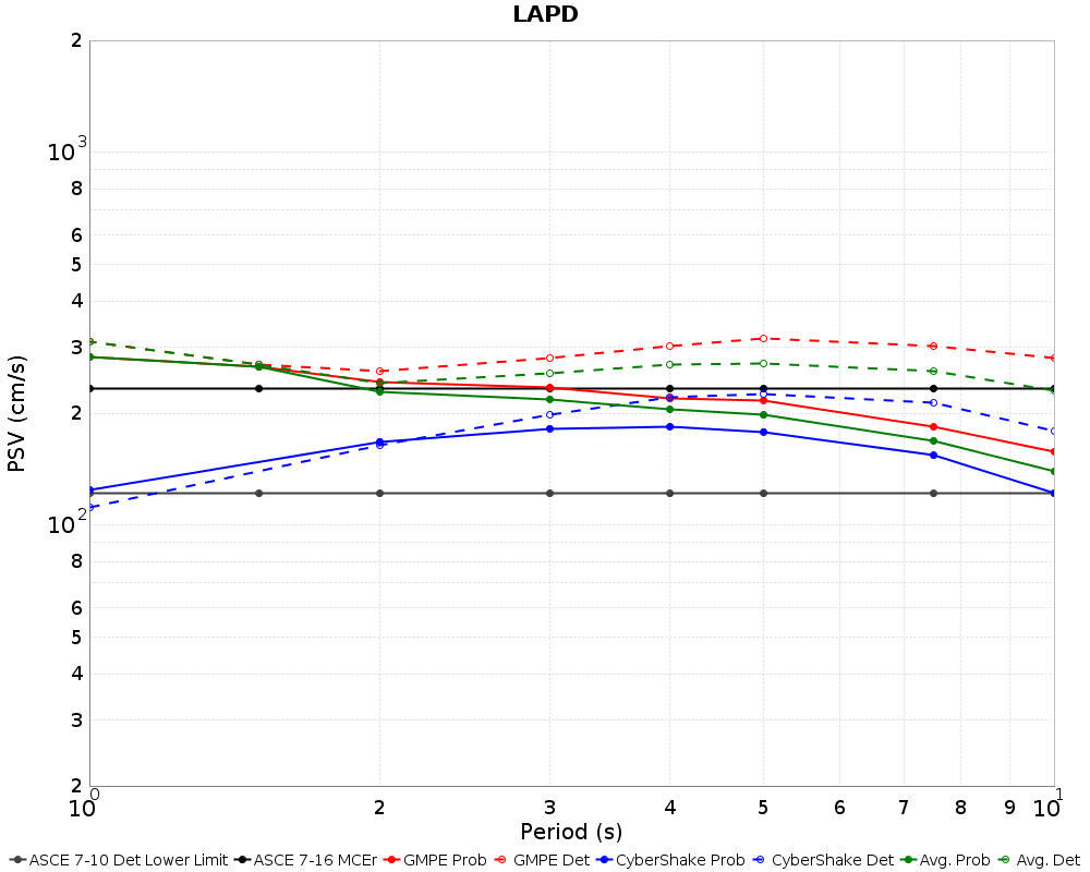
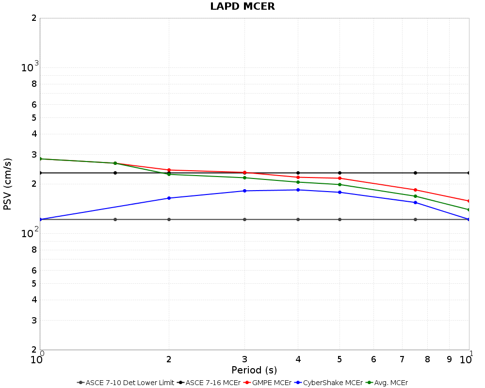
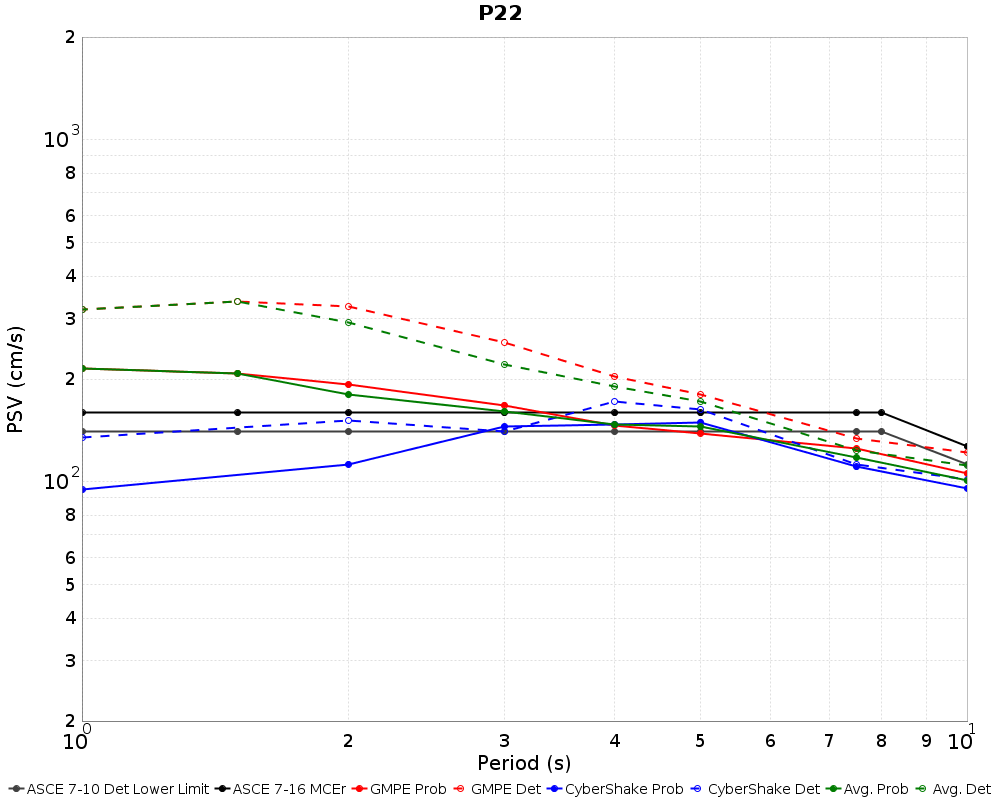
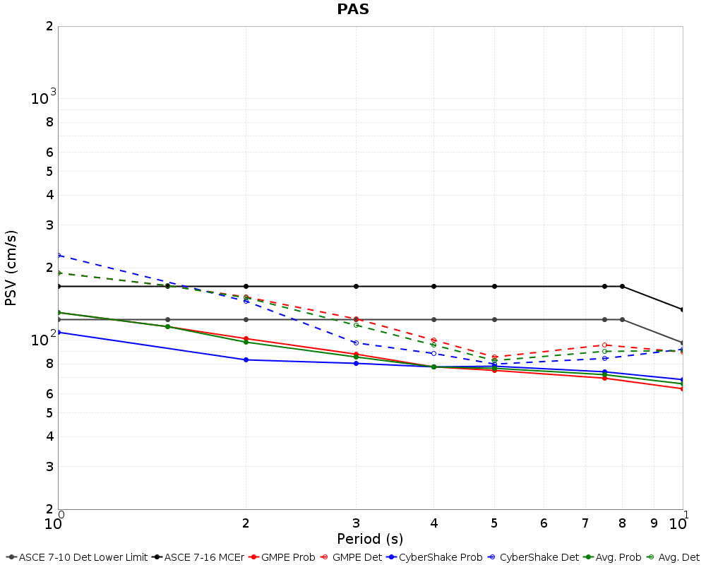
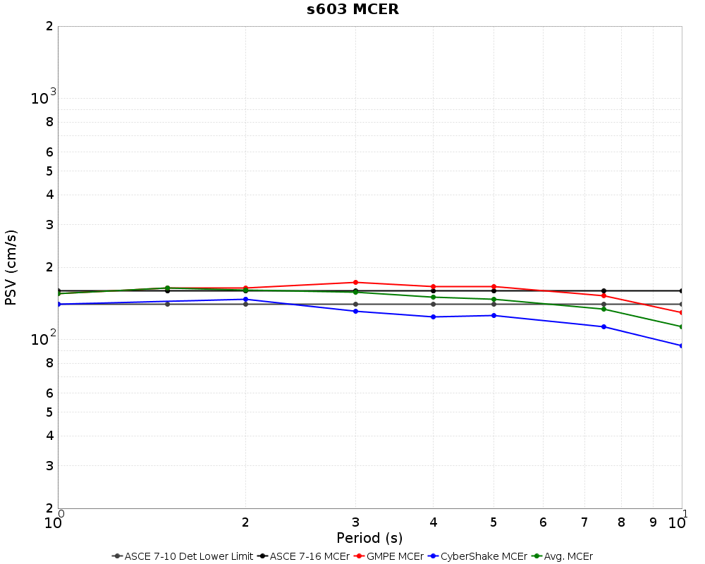
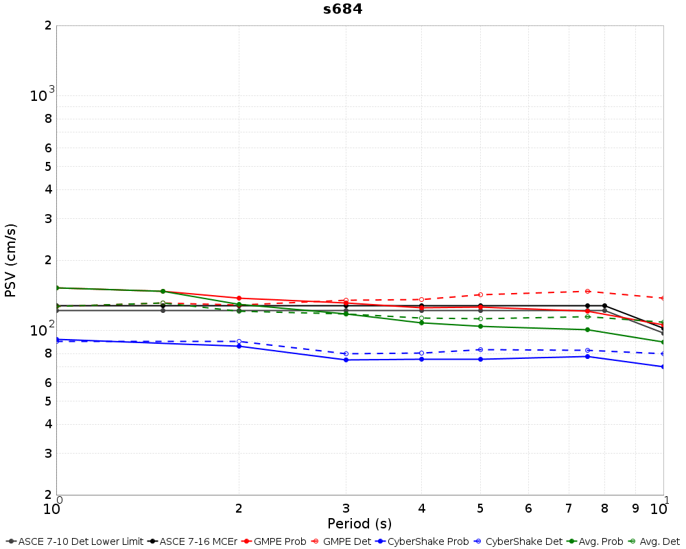
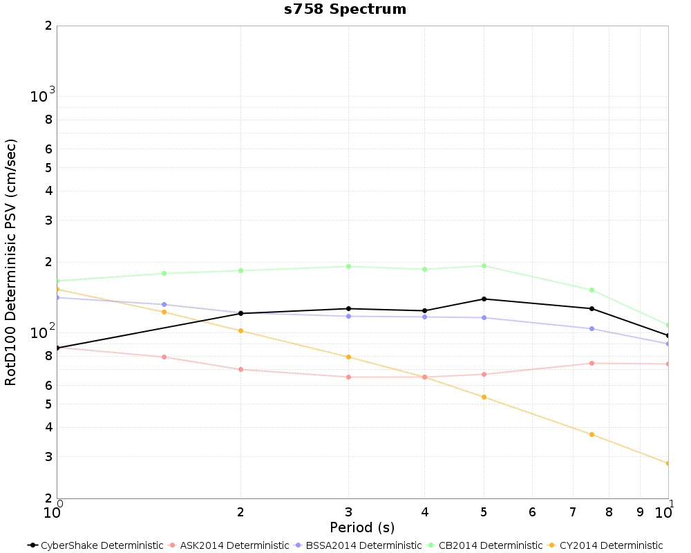
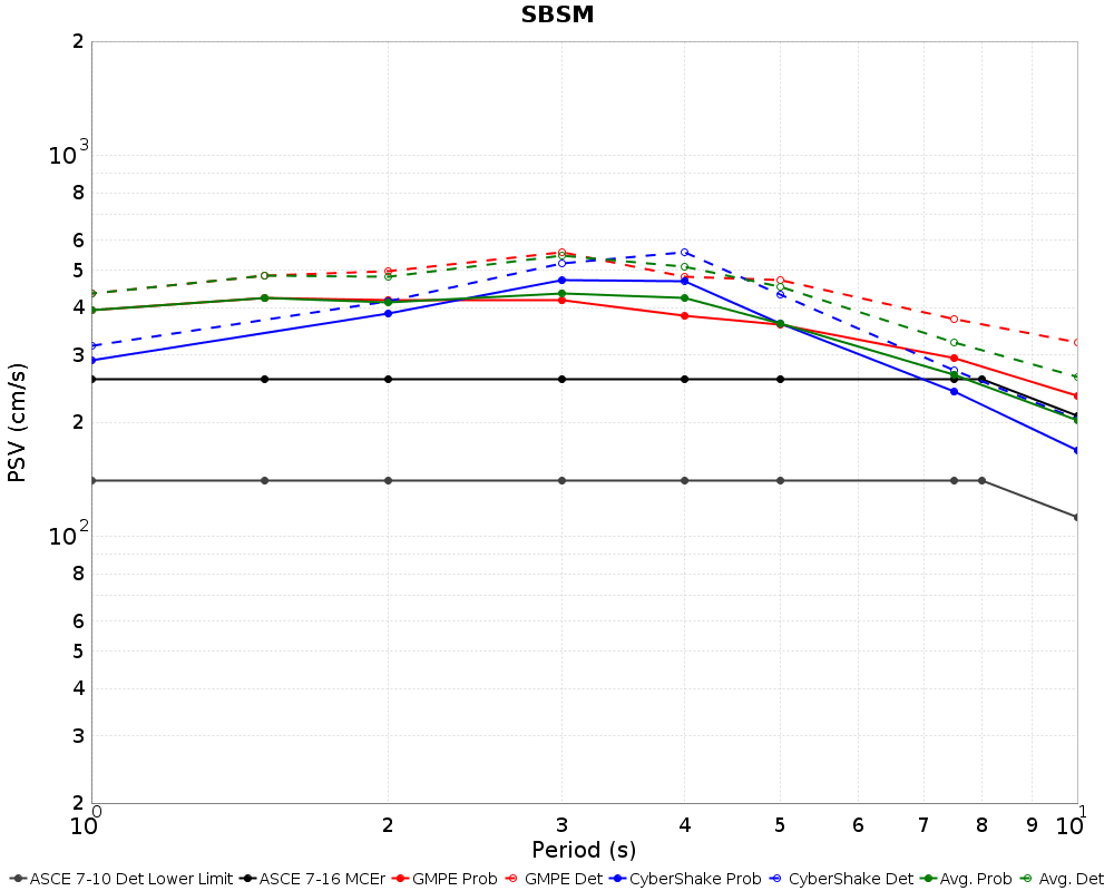
Individual Site MCER Results
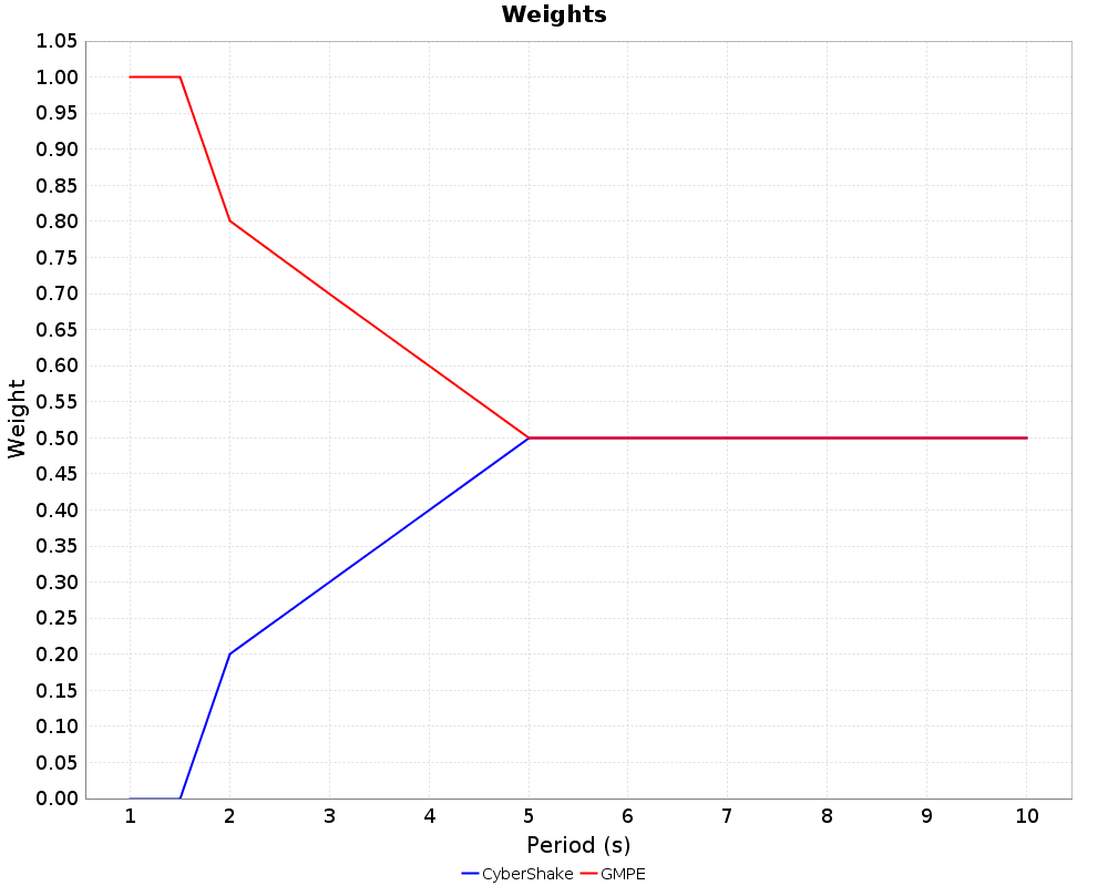
CyberShake/GMPE Combined Weights
The average spectrum (green lines in the above plots) represent a weighted average of CyberShake and the GMPEs. The weights are period dependent as shown below. Probabilistic results are averaged at the hazard curve level prior to calculation of the Risk Targeted Ground Motion value and deterministic results are averaged after deterministic calculation.
 |

